

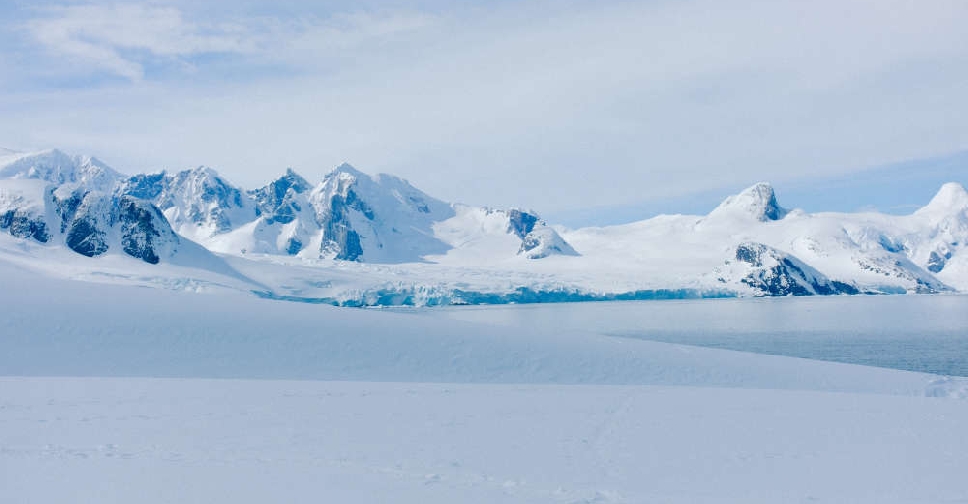
Scientists have devised the most detailed map to date of the terrain hidden below the vast ice sheet blanketing Antarctica, uncovering an exuberant landscape of mountains, canyons, valleys and plains while discerning for the first time tens of thousands of hills and other smaller features.
The researchers used the latest high-resolution satellite observations and a method called ice-flow perturbation analysis, which estimates subglacial topography and conditions based on surface features, to map the full continent including previously uncharted parts.
Improved knowledge of the subglacial bedrock landscape may aid in forecasts concerning the climate-related retreat of Antarctica's ice sheet.
Previous research indicated that rough terrain like jagged hillsides and mountaintops can slow this retreat.
"Having the most accurate map of Antarctica's bed shape is crucial, because the shape of the bed is an important control on friction acting against ice flow, which in turn we need to include in numerical models that are used to project how rapidly Antarctica's ice will flow towards the ocean, melt and contribute to global sea-level rise," said glaciologist Robert Bingham of the University of Edinburgh in Scotland, who helped lead the study published this week in the journal Science.
The researchers were able to map the subglacial terrain with unprecedented precision. For instance, they identified more than 30,000 previously uncharted hills, defined as terrain protuberances of at least 165 feet (50 metres).
Antarctica is about 40 per cent larger than Europe, 50 per cent larger than the United States and roughly half the area of Africa.
"In every case, all of these continents contain an array of very different landscapes in themselves, from towering mountain ranges to immense flat plains. The hidden landscape of Antarctica also contains these vast extremes," Bingham said. "Boring it is not."
The Antarctic Ice Sheet is the largest mass of ice on Earth and holds about 70 per cent of the planet's freshwater. Its average thickness is estimated at about 1.3 miles (2.1 km), with a maximum thickness of about 3 miles (4.8 km).
Antarctica has not always been covered in ice. Its subglacial features initially were sculpted before the continent acquired its icy covering more than 34 million years ago before being further modified by the dynamic ice sheet.
Antarctica once was connected to South America but separated due to a process called plate tectonics involving the gradual movement of continent-sized plates on the Earth's surface.
The map revealed a landscape bearing various topographical features.
"Possibly the type of landscape that many people might know less is 'plateaus dissected by deep-carved glacier valleys.' I can tell you this is very familiar for Scots, but also a landscape that is common across Scandinavia, northern Canada and Greenland.
In fact, the very fact that the landscape our technique has uncovered across Antarctica matches these landscapes so well gives us great confidence in our new map," Bingham said.
The researchers noted that until now the surface of Mars was better mapped than the subglacial terrain of Antarctica.
Traditionally, scientists have mapped the subglacial landscape using radar equipment suspended on planes or towed by snowmobiles, according to glaciologist Helen Ockenden of the Institut des Geosciences de l'Environnement in France, lead author of the study.
"But these surveys often have gaps of 5 km (3.1 miles) or 10 km (6.2 miles) between them, and sometimes up to 150 km (93 miles)," Ockenden said.
The method used in the new study, Ockenden said, "is really exciting because it allows us to combine the mathematics of how the ice flows with high-resolution satellite observations of the ice surface, and say what the landscape beneath the ice must look like everywhere across the whole continent, including in all those survey gaps. So we really gain a much more complete idea of how all the landscape features connect together."
The researchers hope the map will help inform models used to project future sea-level rise as well as the forecasts issued by the IPCC, the UN Intergovernmental Panel on Climate Change that provides governments with data to shape climate-related policies.
"We can now also identify better where Antarctica needs more detailed field survey, and where it does not," Bingham added.

 Dancing robots bring support, company to Barcelona elderly
 Abandoned baby monkey finds comfort in stuffed orangutan, charming zoo visitors
 Doberman named Penny wins Westminster dog show
 Japan-born pandas Xiao Xiao and Lei Lei arrive home in China's Sichuan
 Accidental 'crying horse' toy wins hearts in China